Amazing drone pictures show exactly what's going on behind Milton Keynes' longest road closure
and live on Freeview channel 276
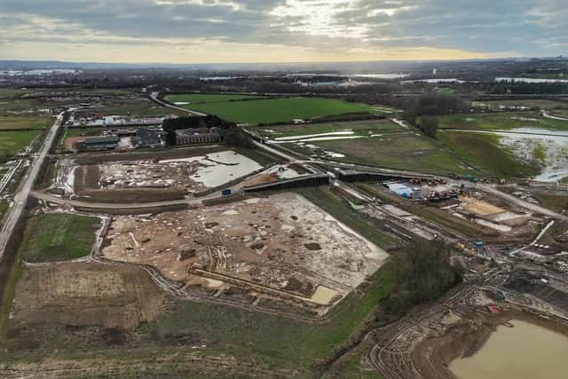
Specialist photography company Drove Over MK has taken amazing images to show people the reason behind the longest road closure in Milton Keynes.
Part of the A509 between Newport Pagnell and Junction 14 of the M1 has been closed since last September and will remain closed for at least another eight months, causing chaos for motorists.
Advertisement
Advertisement
The move is to facilitate the building of the early stages of a massive housing development called MK East, which requires a resign of the road network.
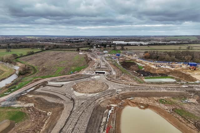

MK East, spanning 461-hectares between Newport Pagnell and the M1, will eventually bring 5,000 new homes, a community hub and a primary school, local shops and employments zones.
It will include a new 63-hectare ‘river valley park’ providing additional green space for residents.
The huge amount of infrastructure work needed means a section of the A509 from the junction with Newport Road to Cranfield and Tickford Roundabout (A422) was closed to traffic on 25 September 2023 and will remain closed, 24 hours a day, seven days a week, until Friday September 27 this year. Traffic must use the diversion route via the V8 Marlborough Street, onto H3 Monks Way.
Advertisement
Advertisement
And even after September 27, sections of the road are likely to closed for another six months - until early 2025 – city officials have warned.
This week, following “multiple requests” from the public, Drone Over MK photographer Chris Read decided to explore from above how the development is progressing. You can view the pictures on the Drove Over MK Facebook page here.
Chris said: “ A new housing development is in its early stages of build along with a redesign of the road network. On Sunday we took a look over the area to see what has changed over the months.”
The photos show a new roundabout and the new road being built seemingly right through the middle of the new estate. Surprisingly, it does not appear to be a dual carriageway.
Advertisement
Advertisement
Meanwhile, Milton Keynes City Council says it has been collaborating closely with the MK East developers to reduce the effect of the road closure “as much as [possible”.
Councillor Lauren Townsend, Cabinet Member for Public Realm said, “We appreciate that any long-term road closure causes inconvenience...The new development here will bring some 5,000 new properties to the area as well as employment land for businesses.”
But many people, including MP Ben Everitt, are not happy and have have questioned why the new access road has not been built in advance of the A509 closure, which would have lessened the traffic impact on Newport Pagnell residents and those in the rural villages.
Mr Everitt said in the House of Commons when the MK East plan was first announced: “Reckless over expansion in rural areas is a real and pressing danger. My constituents who live in rural communities and market towns such as Olney and Newport Pagnell do not want and do not deserve to be swamped by poorly planned sprawling housing developments.
“We need to make planning work better for people and their communities, we need to get back to those pure principles just as the visionaries who built Milton Keynes did.”